| St. Armands Residents Association |

- Home
- Issues
- Infrastructure
- Stormwater Management
- Interactive Map
Stormwater Interactive Map
There are several online maps to help understand flooding issues on St. Armands Key, and the stormwater system that has been put in place to address this. |
Map #1 - Community Flood Area MapClick here to view the Community Flood Area Map which shows where there is recurring flooding throughout St. Armands Key. You will need to zoom in on the map in order to find and view St. Armands Key. Screenshot from the map:
|

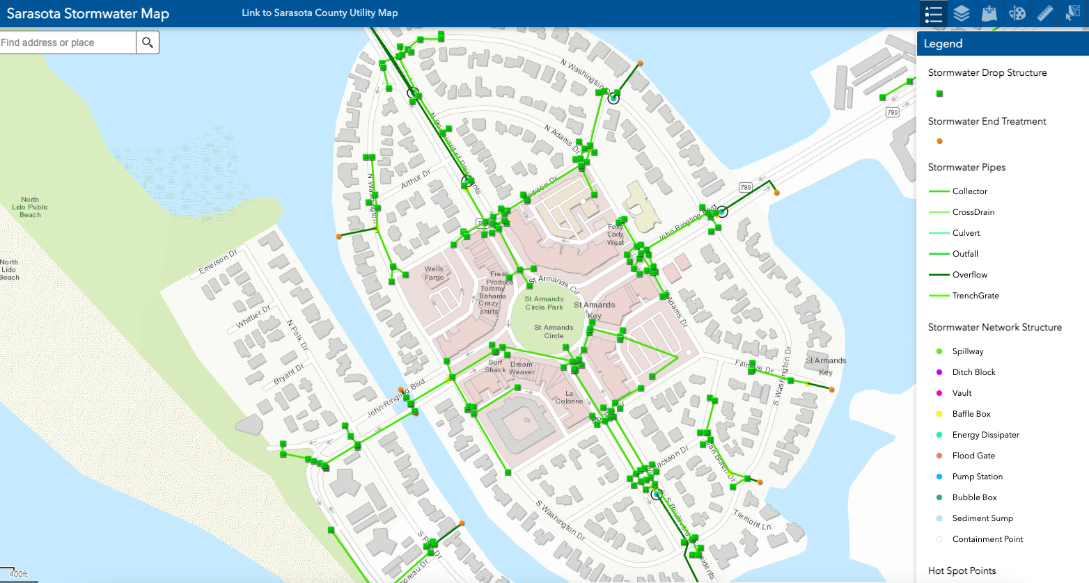
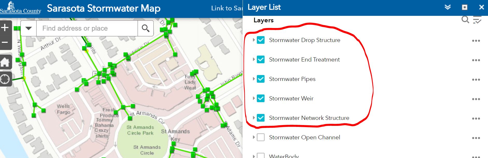
Map #2 - Stormwater System MapClick here to view an online, interactive Sarasota Stormwater Map showing the location of storm drains, discharge pipes, and other elements of the stormwater management system. You will need to zoom in and out to find St. Armands Key, and then click on the "legend" and "layers" buttons (top right) to view or specify what gets shown on the map. Screenshot from the map:
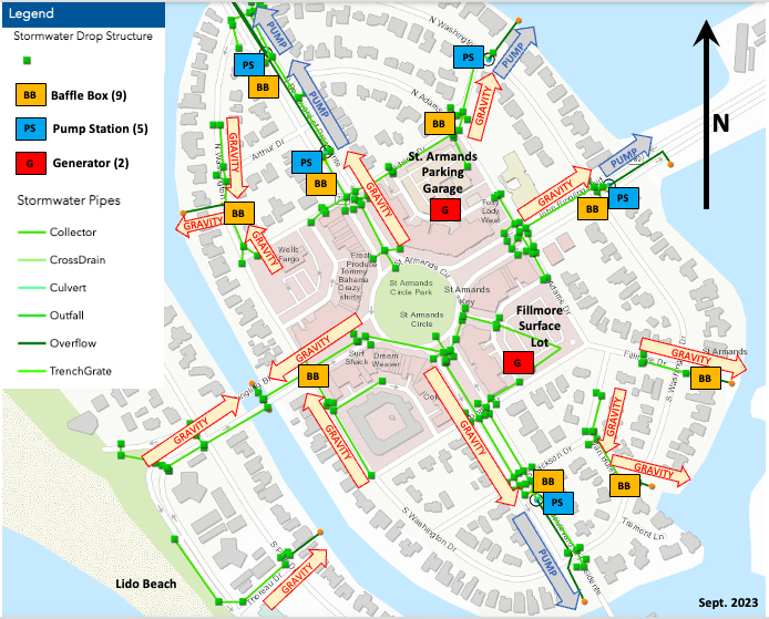
Note: There are some stormwater management features on the west side of St. Armands that are not incorporated in the interactive map which you can view here. This mapping tool was used to help create the following illustration showing how stormwater gets removed from St. Armands Key:
|
Map #3 - CCNA Stormwater MapClick here to view the Coalition of City Neighborhood Associations (CCNA) Stormwater Map which includes the County Flood Area Map (Map #1, above) with reported areas of street and structural flooding marked on it. You will need to zoom in on the map in order to find and view St. Armands Key. Screenshot from the map:
|


St. Armands Residents Association
P.O. Box 2482, Sarasota, FL 34230
e-mail us at: st.armands.residents.assn@gmail.com